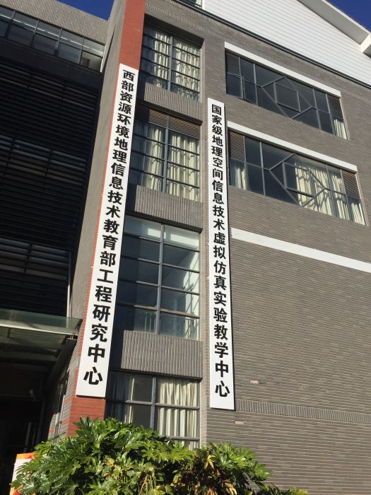
基本介紹
- 中文名:西部資源環境地理信息技術教育部工程研究中心
- 成立時間:2008年
- 位置:雲南
- 固定工作人員:85人
簡介,地位,任務,
簡介
本中心在現任主任雲南師範大學信息學院院長楊昆教授的帶領下,已經發展成為具有固定工作人員85人 (博士學位78人),其中教授20人,副教授30人,在讀博士研究生15人,碩士研究生86人的大型科研團隊。同時本中心也擁有“地圖學與地理信息系統”一個博士學位授權點,以及 “地圖製圖學與地理信息工程”、“地圖學與地理信息系統”、"農業信息化"、“計算機套用技術”和“軟體工程”5個碩士學位授權點。
自中心成立以來,先後承擔了國家973、國家863、國家科技支撐、國家科技惠民計畫,國家自然科學基金、雲南省社發重大項目、重點行業套用等100餘項科研項目,累計科研經費9000餘萬元。先後出版學術專著10餘部、在國內外重要學術期刊發表學術論文200多篇(其中SCI 、 EI 、 ISTP三大檢索文章到達150餘篇)、獲得軟體著作權登記30餘項、在警用地理信息系統建設方面主持研製國家行業技術標準1部。未來,本中心將努力打造成為立足雲南,引領西部,服務東南亞的國際領先GIS工程研究中心、人才培養基地,以及相關技術產業化的孵化站。
Under the leadership of the current director Prof. Yang Kun, who is the dean of the School of Information Science and Technology, the center has become a big research team, where 85 faculties (78 people have PhD degree), 20 professors, 30 associate professors, 15 PhD students and 86 Master students are working in. Moreover, The center offers one PhD program in cartography and geographic information systems, and four Master programs in cartography and geographic information engineering, cartography and geographic information systems, computer science and technology, and software engineering.
Since its establishment, the center has undertaken more than 100 projects from National 973 Projects , National 863 Projects, National Science and Technology Support Projects, National Science and Technology Benefit Projects, National Natural Science Funds, etc, and accumulated the research founding around 90 million RMB. The center has published more than 10 books, over 200 articles (over 150 papers indexed by SCI, EI and ISTP) in domestic and international academic journals and conferences, obtained over 30 copyrights of computer software, and formulated a national technical standard in the police geographic information system. Future, the center will keep striving to be grounded on Yunnan, leading west China and serving southeast Asia. Meanwhile we will keep striving to build the center for an international leading research center, talent cultivation base and technology incubator.
主要實驗室:
u 智慧型空間信息處理
Intelligent Spatial Information Processing Lab
u 地理過程與環境模擬
Geographical Process and Environmental
Simulation Lab
u 遙感技術套用
Remote Sensing Technology and Application
Lab
u GIS軟體工程
GIS Software Engineering Lab
u 數位化製圖繪圖
Digital Mapping Lab
u 高性能計算
High Performance Computing Lab
u 移動位置信息服務
Location Based Services Lab
u 資源環境數據共享
Resources and Environmental Science
Data Sharing Lab
u 空間信息與數位技術
Spatial Information and Digital
Technology Lab
u GIS產業化服務
GISIndustry Service Lab
u 空間數據挖掘與分析
Spatial Data Mining and Analysis Lab
u 虛擬GIS技術
Virtual GIS Technology Lab
地位
地理信息技術被認為是一種解決資源與環境問題和進行科學決策的重要工具。我國在地理信息技術領域已經建成並投入運行的教育部工程研究中心現有中國地質大學的地理信息系統軟體及其套用教育部工程研究中心、首都師範大學的空間信息技術教育部工程研究中心和雲南師範大學的西部資源環境地理信息技術教育部工程研究中心三個。
任務
能夠加快我國地理信息技術成果轉化,能夠有效地保障國家信息安全,提高國防實力,促進國民經濟快速穩定的發展。從區域發展看,西部缺少國家層面的工程研究中心,尤其是對於雲南省來說,地處中國西部地區,毗鄰東協各國,環境、生物、民族與文化多樣性資源豐富,空間分布複雜,急需用GIS技術進行規劃、保護與管理。因此,我校西部資源環境地理信息技術教育部工程研究中心的成立,有利於促進西部地區GIS技術水平的迅速提高與推廣套用。

