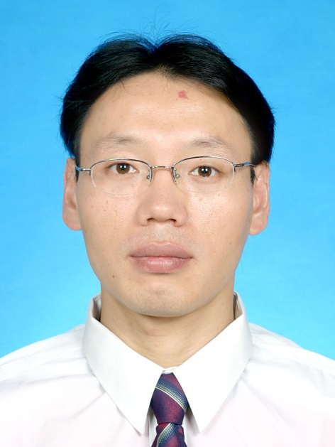
石玉立,1973年10月出生,男,博士,南京信息工程大學遙感與測繪工程學院教授,碩士生導師。
基本介紹
- 中文名:石玉立
- 國籍:中國
- 出生日期:1973年10月
- 畢業院校:北京師範大學 、成都信息工程大學
- 學位/學歷:博士
- 職業:大學教授
- 專業方向:地圖學與地理信息系統
- 職務:遙感與測繪工程學術委員會委員
- 任職院校:南京信息工程大學遙感與測繪工程學院
- 職稱:教授
個人經歷,研究方向,主講課程,學術成果,
個人經歷
教育背景
2001/09-2006/06 北京師範大學 地圖學與地理信息系統專業 博士
2001/09-2003/06 北京師範大學 地圖學與地理信息系統專業 碩士
1992/09-1996/07 成都氣象學院 天氣動力學 本科
工作經歷
2017/11-至今 南京信息工程大學 遙感與測繪工程學院 教授
2017/07-2017/10 南京信息工程大學 地理與遙感學院 教授
2012/09-2017/06 南京信息工程大學 地理與遙感學院 副教授
2011/09-2012/09 波士頓大學 地理與環境系 訪問學者
2006/09-2008/06 中國科學院地理科學與資源研究所 水循環室 博士後 助研
學術兼職
擔任遙感與測繪工程學術委員會委員;
擔任多個國際和國內期刊審稿人,包括國際知名期刊International Journal of Remote Sensing,Journal of Hydrometeorology和Remote Sensing等。
研究方向
資源環境遙感
主要研究領域:
主講課程
學術成果
近期主要論著
Ni X, Cao C, Zhou Y, et al. Estimation of Forest Biomass Patterns across Northeast China Based on Allometric Scale Relationship[J]. Forests, 2017, 8(8):288.;
Choi S, Kempes C P, Park T, et al. Application of the metabolic scaling theory and water–energy balance equation to model large‐scale patterns of maximum forest canopy height[J]. Global Ecology & Biogeography, 2016, 25(12):1428-1442.;
顏婉倩, 鞏宇涵, 石玉立. 以安卓智慧型手機為平台的樹木高度測量技術[J]. 江蘇林業科技, 2016, 43(4):40-43.;
Shi Y, Song L. Spatial Downscaling of Monthly TRMM Precipitation Based on EVI and Other Geospatial Variables Over the Tibetan Plateau From 2001 to 2012[J]. Mountain Research & Development, 2015, 35(2).;
Ni X, Zhou Y, Cao C, et al. Mapping Forest Canopy Height over Continental China Using Multi-Source Remote Sensing Data[J]. Remote Sensing, 2015, 7(7):8436-8452.;
Ni X, Park T, Choi S, et al. Allometric Scaling and Resource Limitations Model of Tree Heights: Part 3. Model Optimization and Testing over Continental China[J]. Remote Sensing, 2014, 6(5):284-306.;
石玉立,夏振,王林,基於IDL的視頻圖像水位檢測新算法,科學技術與工程,2014,(29):114-116.;
Choi S, Ni X, Shi Y, et al. Allometric Scaling and Resource Limitations Model of Tree Heights: Part 2. Site Based Testing of the Model[J]. Remote Sensing, 2013, 5(1):202-223.;
Shi Y, Choi S, Ni X, et al. Allometric Scaling and Resource Limitations Model of Tree Heights: Part 1. Model Optimization and Testing over Continental USA[J]. Remote Sensing, 2013, 5(1):284-306.;
Shi Y. Thermal infrared inverse model for component temperatures of mixed pixels[J]. International Journal of Remote Sensing, 2011, 32(8):2297-2309.;
石玉立. 中巴地球資源衛星數據反演地表溫度產品設計[J]. 氣象與環境科學, 2009, 32(1):5-8.。
近期科研項目
國家自然科學基金面上項目 4157011325 城市邊緣區地表組分溫度反演模型的構建 2016/01-2019/12 在研 參加
國家自然科學基金面上項目 41471312 異速增長和資源限制模型結合多源衛星遙感數據估算森林地上生物量研究 2015/01-2018/12 在研 主持
國家自然科學基金面上項目 41175077 複雜地形下月平均氣溫分散式模型研究 2012/01-2015/12 已結題 參加
國家自然科學基金青年基金項目 40801139 方向性亮度溫度和半球積分熱輻射的關係研究 2009/01-2011/12 已結題 主持

