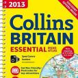
《2013 Collins Essential Road Atlas Britain》是一本圖書,作者是HarperCollins UK; Collins UK;
基本介紹
- 外文名:2013 Collins Essential Road Atlas Britain
- 作者:HarperCollins UK; Collins UK;
- 出版時間:2012年9月
- 頁數:336 頁
- ISBN:9780007468614
- 定價:147.00 元

《2013 Collins Essential Road Atlas Britain》是一本圖書,作者是HarperCollins UK; Collins UK;
《2013 Collins Handy Road Atlas Britain》是一本圖書,作者是Collins UK 內容簡介 This easy-to-use, handy A5 sized road atlas is your ideal travelling companion. It has extremely clear, route planning maps of Britain and ...
《2013 Collins Essential Road Atlas Europe》是一本圖書,作者是Collins UK 內容簡介 This fully-revised A4 spiral bound road atlas of Europe contains clear, detailed road mapping, route planning maps, large scale road maps ...
《2011 Collins Essential Road Atlas Britain》是一本圖書,作者是Collins UK 內容簡介 This road atlas with popular lie-flat spiral binding features clear, detailed road mapping, at a scale of 3.2 miles to 1 inch, with ...
《2012 Collins Handy Road Atlas Britain》是一本圖書,作者是Collins UK 內容簡介 This handy A5 sized road atlas makes it the ideal travelling companion. It has extremely clear, route planning maps of Britain and Ireland ...
《2012 Collins Big Road Atlas Britain》是一本圖書,作者是Collins UK 內容簡介 The ultimate 3.2 miles to 1" scale large format atlas for the year 2012, featuring Collins well established mapping; designed for exceptional ...
《2013 Collins Big Road Atlas Britain》是一本圖書,作者是HarperCollins UK; Collins UK;內容簡介 The ultimate 3.2 miles to 1 inch scale large format paperback road atlas for 2013, featuring Collins' popular and well-...
《2010 Collins Essential Road Atlas Britain》是一本圖書,作者是Collins UK 內容簡介 This road atlas with popular lie-flat spiral binding features clear, detailed road mapping, at a scale of 3.2 miles to 1 inch, with ...
《2011 Collins Handy Road Atlas Britain》是一本圖書,作者是Collins UK 內容簡介 Fully updated, this atlas featuresmaps of Britain at 9.9 miles to 1 inch. Thereis also a selection of more detailed urban area maps at ...
《2010 Collins Big Road Atlas Britain》是一本圖書,作者是Collins UK 內容簡介 The ultimate 3.2 miles to 1 inch scale large format road atlas for the year 2010 features Collins' popular and well established road mapping,...
《2010 Collins Fold Out Road Atlas Britain》是一本圖書,作者是Collins UK 內容簡介 Despite the compact size of the atlas, each mapping page folds out to reveal a large area of mapping at a scale of 3.2 miles to 1...
2012 Collins Europe Essential Road Atlas 《2012 Collins Europe Essential Road Atlas》是一本圖書,作者是Collins UK
《2011 Collins Essential Road Atlas Europe》是一本圖書,作者是Collins UK 內容簡介 Updated for2011 toincreased map coverage in eastern Europe to cover Belarus and the Ukraine, as well as up-to date digital mapping This...
2011 Collins Big Road Atlas Britain 《2011 Collins Big Road Atlas Britain》是一本圖書,作者是Collins UK
《2010 Collins Handy Road Atlas Britain & Ireland》是一本圖書,作者是Collins UK 內容簡介 Fully updated, this atlas featuresmaps of Britain at 9.9 miles to 1 inch and the whole of Ireland is covered at 15.8 miles ...
