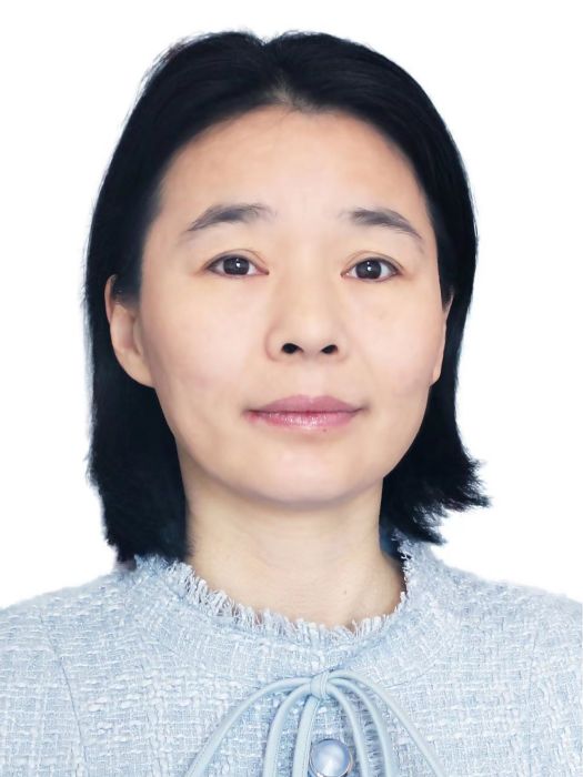
研究方向
農業防災減災智慧型監測,礦山環境遙感監測,遙感智慧型解譯
人物經歷
教育與學歷
2014/07 - 2015/07,新布倫瑞克大學,訪問學者。
2007/07 - 2007/09,香港中文大學,地理與資源管理學系,助理研究員。
2003/07 - 2006/09,武漢大學,攝影測量與遙感專業,博士。
工作經歷
2009/01 -至今,中國礦業大學,環境與測繪學院,副教授。
2006/07 - 2008/12,中國礦業大學,環境與測繪學院,講師。
科研成果
學術論文
A Novel Object Detection Model Based on Faster R-CNN for Spodoptera frugiperda According to Feeding Trace of Corn Leaves
Feature Selection via Cramer's V-Test Discretization for Remote-Sensing Image Classification
An Investigation of a Multidimensional CNN Combined with an Attention Mechanism Model to Resolve Small-Sample Problems in Hyperspectral Image Classification
A Novel Method to Extract Narrow Water Using a Top-Hat White Transform Enhancement Technique
Detection of Spatiotemporal Changes of Surface Mining Area in Changting County Southeast China
智慧農田害蟲時空監測系統設計
基於卷積神經網路的遙感圖像變化檢測
基於改進Faster-RCNN模型的粘蟲板圖像昆蟲識別與計數
The safety study of heavy metal pollution in wheat planted in reclaimed soil of mining areas in Xuzhou, China
An Approach for Rice Bacterial Leaf Streak Disease Segmentation and Disease Severity Estimation
基於紋理轉移的露天礦區遙感圖像超解析度重建
A Framelet-Based SFIM Method to Pan-Sharpen THEOS Imagery
基於紋理轉移的露天礦區遙感圖像超解析度重建
基於改進Faster-RCNN模型的粘蟲板圖像昆蟲識別與計數
An Investigation of a Multidimensional CNN Combined with an Attention Mechanism Model to Resolve Small-Sample Problems in Hyperspectral Image Classification
Detection of Spatiotemporal Changes of Surface Mining Area in Changting County Southeast China
Feature Selection via Cramer's V-Test Discretization for Remote-Sensing Image Classification
An Approach for Rice Bacterial Leaf Streak Disease Segmentation and Disease Severity Estimation
The safety study of heavy metal pollution in wheat planted in reclaimed soil of mining areas in Xuzhou, China
A Novel Method to Extract Narrow Water Using a Top-Hat White Transform Enhancement Technique
A Novel Object Detection Model Based on Faster R-CNN for Spodoptera frugiperda According to Feeding Trace of Corn Leaves
A Framelet-Based SFIM Method to Pan-Sharpen THEOS Imagery
Combining Spectral and Texture Features of UAS-Based Multispectral Images for Maize Leaf Area Index Estimation
基於改進UNet孿生網路的遙感影像礦區變化檢測
基於改進RetinaNet的冷卻塔目標檢測
西北地區三維生態足跡生態安全評價及驅動力分析
基於RandLA-Net的機載雷射雷達點雲城市建築物變化檢測
面向對象的多特徵分級CVA遙感影像變化檢測
汪家亮,趙銀娣.結合分割線網路的遙感影像鑲嵌及ENVI/IDL實現,2018
汪霞,趙銀娣.一種低重疊率雷射點雲的配準方法,2018
郭欣,趙銀娣.基於Sentinel-1A SAR的湖南省寧鄉市洪水淹沒監測,2018
趙敏,趙銀娣.面向對象的多特徵分級CVA遙感影像變化檢測,2018
夏思璐,趙銀娣.在水平集框架下的遙感影像湖泊輪廓線提取,2017
趙銀娣.“遙感原理與套用”微課程設計與製作.非核心期刊,2016
常方正,趙銀娣.遙感影像CVA變化檢測的CUDA並行算法設計,2016
趙銀娣.Level Set Based Extraction and Update of Lake Contours Using Multi-Temporal Satellite Images,2015
苗聰聰,趙銀娣.Rotation-invariant image retrieval using hidden Markov tree for remote sensing data,2014
馮淑娜,趙銀娣.Validation of the Morphological Compositing Method for ZY-3 Satellite Imagery,2014
白楊,趙銀娣.一種 改進的K2DPCA高光譜遙感圖像降維方法,2014
趙銀娣.Remote Sensing Image Mosaic by Combining Segmentation and Shortest Path,2013
韓天慶,韓天應,趙銀娣.空間約束的無人機影像SURF特徵點匹配,2013
韓冰,趙銀娣.遙感圖像分割的疊代上下文融合小波域HMT模型,2013
白楊,趙銀娣.基於KPCA和FCM的HJ-1A星遙感數據分類,2013
趙銀娣.Experiment Teaching in Course of Remote Sensing Digital Image Processing with Visual C++ Programming,2013
韓冰,趙銀娣.一種改進的SFIM高光譜圖像融合算法,2012
劉善磊,趙銀娣.一種關鍵幀的自動提取方法,2012
趙銀娣.基於知識庫的面向對象衛星雲圖分類,2012
戈樂樂,趙銀娣.五種分割算法在高解析度遙感圖像中的適用性分析,2012
杜會建,趙銀娣.一種顧及上下文的高光譜遙感圖像端元提取方法,2012
劉善磊,趙銀娣.POS數據用於雙介質水下地形攝影測量的研究,2011
趙銀娣.基於CBERS CCD 數據的鹿窪煤礦塌陷區LUCC 檢測,2011
郭艷,趙銀娣.黑龍江多寶山地區遙感找礦蝕變異常提取方法研究,2011
趙銀娣.Feature-Based Geometric Registration of High Spatial Resolution Satellite Imagery,2010
趙銀娣.Pixel Unmixing for Urban Environment Monitoring Using Multi-Temporal Satellite Images,2010
趙銀娣.基於立體環形鄰域的GMRF模型及其在遙感影像紋理識別中的套用,2009
趙銀娣.基於環形馬爾可夫模型的紋理圖像分類,2009
趙銀娣.研究型教學模式在地球信息科學課程中的實踐,2009
趙銀娣.Incorporating spectral, texture, and shape information for high spatial resolution satellite imagery classification,2008
趙銀娣.《遙感原理與套用》課程教學改革探析,2008
趙銀娣.Classification of high spatial resolution imagery using optimal gabor filters-based texture features,2007
趙銀娣.Classification of High Spatial Resolution Imagery Using Imporved Gaussian Markov Random-Field-Based Texture Features,2007
科研項目(2010-2018)
1. 梨小食心蟲智慧型監測技術研究
2. 基於點雲與影像的城市典型地物變化檢測關鍵技術研究
3. 點雲與序列影像融合的實景三維模型構建
4. 基於機器視覺的植物病蟲害智慧型監控系統研究
5. 基於深度學習的城市高分遙感變化檢測研究
6. 面向對象的序列遙感影像接縫線自動提取算法研究
7. 任務驅動下的遙感影像目標變化檢測算法研究
8. 高空間解析度遙感影像分類學習方法及其實現研究
9. 基於隱馬爾科夫樹模型的高解析度遙感影像分類若干問題研究
10. 馬爾可夫模型的擴展及其在高空間解析度遙感影像分類中的套用研究

