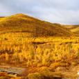
烏蘭察布高原亞區位於呼倫貝爾—錫林郭勒高原之西。海拔由2200米降至900米,至中蒙邊界又略有升高,為一低山丘陵帶.南部狼山是乾燥剝蝕中山,主峰達2341米,北坡緩,南坡陡。年雨量150—250毫米。
基本介紹
- 中文名:烏蘭察布高原亞區
- 地理位置:呼倫貝爾—錫林郭勒高原之西
- 年雨量:年雨量150—250毫米
- 全年日照時數:320—3300小時
- 年平均溫度:2°—6℃
南以狼山和烏拉山南坡斷層與後套平原分開.地勢由南向北傾斜,海拔由2200米降至900米,至中蒙邊界又略有升高,為一低山丘陵帶.南部狼山是乾燥剝蝕中山,主峰達2341米,北坡緩,南坡陡,分水嶺向北經低山、丘陵而過渡到高原.高原主體是由古湖盆上升而成的構造剝蝕高原,呈階梯狀,有四、五級平坦面,逐級下降,主要由第三紀泥岩和紅色砂岩組成.乾旱程度向西增強,東部稍濕潤,地面受河流侵蝕切割,形成南北向的台間淺窪地,散布著古河道和古湖盆地遺蹟.西部乾燥剝蝕作用強烈,地面多東北向的石質殘丘、壟崗和一列系寬淺的風蝕窪地,丘崗間堆積著沙礫岩、泥岩等碎屑物質,成為戈壁礫石和沙漠沙的物質基礎.高原西北部窪地中散布著石質戈壁,西南部為雅瑪利克沙帶與烏蘭布和沙漠斷續相連,荒漠景觀更趨明顯.氣候乾燥,年雨量150—250毫米,東多西少.年平均溫度2°—6℃,東低西高,1月平均氣溫介於-14℃至-20℃之間,7月平均氣溫22°—24℃.光熱資源豐富,牧草生長期內有效積溫250°—30℃,全年日照時數320—3300小時.河流稀少,僅塔布河、艾不蓋河較大.湖泊一般礦化度較高,不宜人畜飲用.地下水依賴雨水補給,水量較小,水質較差,埋藏深度南深北淺,潛水位在70—30米,開採比較困難.荒漠草原是草原向荒漠的過渡地帶,氣候上已屬乾旱地區,土壤為棕鈣土,草類自東向西減少,灌木、半灌木自東向西增多.荒漠草原棕鈣土帶的東半部為荒漠化草原暗棕鈣土,西半部為草原化荒漠淡棕鈣土.前者屬草原帶,後者屬荒漠帶的範疇.荒漠化草原一般草高10—15厘米,覆蓋度15—20%左右,高原上是大面積草場.草原化荒漠的植被中起主導作用的是灌木和半灌木飼草.草群明顯地分為兩層.草本層高10—15厘米.灌木、半灌木高15—30厘米.產草量略低於荒漠草原,其中灌木、半灌木飼草增多,占40—50%.自然條件及草場資源較差,草群低矮,每畝產草量40—100公斤,牧草中蛋白質含量高,與無氮物質之比為1:44。B河流兩岸有小面積的芨芨草和羊草可做割草場.適於養羊,也適宜養裘、羔皮羊,而山羊又比綿羊更為適宜.駱駝喜食的牧草也較普遍,養駝業向西增加.有水源條件的地方種植優良牧草和飼料作物以及防護林帶,還可發展小塊糧食基地.狼山地勢起伏較大,陡坡基岩裸露,平緩丘頂也有大量碎石覆蓋,草場生產力低.烏拉山位於乾草原與荒漠草原的過渡地帶,自然條件較好,森林主要分布於北坡170—2100米的山谷中,以山楊、白樺為主,林線以上為草甸草原.山間分地牧草較好,可做夏季牧場.In Hulunbeier - Xilin Gol Plateau to the west, the south Urals Langshan and southern slopes of fault and after the separate sets of plain.Topography from south to north slope, elevation from 2,200 meters down to 900 meters, to the Sino-Mongolian border is slightly higher, in order to a hilly belt. Langshan be dry erosion south of Zhongshan, the mainpeakover 2341 meters, North Po Huan, South steep slope, watershed north by low mountains, hills and thetransitionto the plateau. highlands subject is made up by the ancient lake basin tectonic denudation of the plateau, was ladder-like, there are four or five flat surface, step-down, mainly by Tertiary mudstone and red sandstone. arid west extent of enhanced slightly humid eastern part of the ground by the river erosion, cutting, forming between north and south of Taiwan to the shallow depressions, scattered with ancient ruins of rivers and ancient lake basins. denudation in western dry strong north-east to the stone on the ground more residual hill, ridge Kong, and a line of wind erosion wide-shallow depressions, hilly between the accumulation of the gravel rock, shale and other debris material, as the Gobi desert sand gravel and material basis. highlands in the north-west depressions scattered stony desert, south-west of Ya Mali Kashagan with intermittentconnectedwith the Ulan Buh Desert, desert landscapes become more apparent. dry climate and annual rainfall of 150-250 mm, the East over the West less. annual average temperature of 2 ° -6 ℃, low in the east west high, in January the average temperature ranging from -14 ℃ to -20 ℃, betweenJulyThe average temperature of 22 ° -24 ℃. light and heat resources, rich in pasture growth period effective temperature 250 ° -30 ℃, annual sunshine hours 320-3300 hours. rivers, scarce, only Tabou River, Ai does not cover a larger river. lakes in general a higher degree of mineralization is not appropriate human and animal consumption. rely on rainwater recharge of groundwater, water less, water less, burial depth of the deep North-South shallowdivinglocated in 70-30 m, mining more difficult. steppe to desert steppe is desert transitional zone climate on the already-arid areas,soilis brown calcium soil, decrease from east to west grass, shrubs, semi-shrubs increased from east to west. desert steppe brown soil with calcium desertification grassland in the eastern half of the dark brown calcium soil, the western half of steppe desert pale-brown calcium soil. The former is a steppe zone, which is desert areas. desertification grassland in general grass 10-15 cm high, around 15-20% coverage of the plateau is large-scale grassland. steppe desert vegetation played a leading role in the shrub and semi-shrub forage grass. grass clearly divided into two groups. herb layer 10-15 cm high. shrubs, semi-shrub 15-30 cm high. production slightly lower than the amount of desert grass steppe, where shrubs, semi-shrub forage increased, accounting for 40-50%. natural conditions and resources, poor pasture, grass and low groups, the amount of 40-100 kg per mu of grass, forage protein content high, and non-nitrogen ratio of 1:44 substances. B rivers are small areas of Achnatherum and Leymus Mowing can be done. Suitable for sheep, but also appropriate to raise Qiu, kid goats, sheep and the goats off than those more appropriate. Camel grass eating are more common, raisingcamelindustry west to increase. there is water where the conditions of cultivation of good pasture and fodder crops and shelterbelts, but also the development of small grain bases. Langshan undulating terrain, steep slopes with exposed bedrock, gentle Hill Top also has a large number of gravel cover, grassland productivity low. Wulashan dry steppe and desert steppe is located in the transitional zone, natural conditions are relatively good, forests are mainly distributed in the valley in the northern slope of 170-2100 meters in order to Populus, Betula mainly above the forest for the meadow steppe. mt subdivision between the grass is better, to do the summer pastures.

