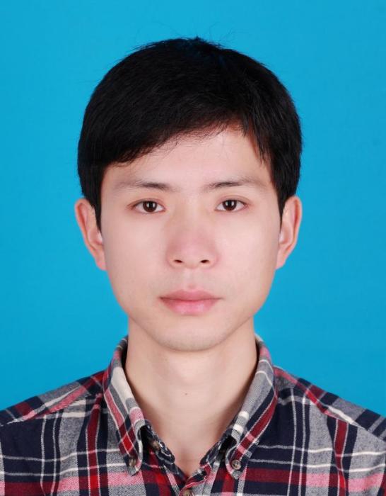
個人經歷
教育經歷
[1]2009.7-2014.6
武漢大學 測繪遙感信息工程國家重點實驗室| 攝影測量與遙感| 博士學位| 博士研究生畢業
[2]2005.9-2009.6
武漢大學| 遙感科學與技術| 學士學位| 大學本科教育
工作經歷
[1]2019.2-至今
地球科學與信息物理學院| 中南大學 副教授
[2]2014.11-2019.1
地球科學與信息物理學院| 中南大學 講師
研究方向
從事航天攝影測量教學研究工作。現主要從事高解析度衛星影像的高精度幾何處理與計算機視覺方面研究。
學術成果
論文成果
[1] Pan H. Geolocation error tracking of ZY-3 three line cameras [J]. ISPRS Journal of Photogrammetry and Remote Sensing, 2017, 123(1): 62-74
[2] Pan H,Tao C,Zou Z. Precise georeferencing using the rigorous sensor model and rational function model for ZiYuan-3 strip scenes with minimum control [J]. ISPRS Journal of Photogrammetry and Remote Sensing, 2016, 119: 259-266
[3] Pan H,Zou Z,Zhang G,Zhu X,Tang X. A penalized spline-based attitude model for high-resolution satellite imagery [J]. IEEE Transactions on Geoscience and Remote Sensing, 2016, 54(3): 1849-1859
[4] Pan H,Zhang G,Tang X,Li D,Zhu X,Zhou P,Jiang Y. Basic Products of the ZiYuan-3 Satellite and Accuracy Evaluation [J]. Photogrammetric Engineering and Remote Sensing, 2013, 79(12): 1131-1145
[5] Zhang G,Pan H,Li D,Tang X,Zhu X. Block adjustment of satellite imagery using RPCs with virtual strip scenes Photogrammetric Engineering and Remote Sensing, 2014, 80(11): 1053-1059
[6] Tao C,Pan H,Li Y,Zou Z. Unsupervised Spectral–Spatial Feature Learning With Stacked Sparse Autoencoder for Hyperspectral Imagery Classification [J]. IEEE Geoscience and Remote Sensing Letters, 2015, 12(12): 2438 - 2442
[7] Tang X,Zhou P,Zhang G,Wang X,Pan H. Geometric accuracy analysis model of the ZiYuan-3 satellite without GCPs [J]. Photogrammetric Engineering and Remote Sensing, 2015, 81(12): 927-934
[8] Zhang G,Wang T,Li D,Tang X,Jiang Y,Huang W,Pan H. Block Adjustment for Satellite Imagery Based on the Strip Constraint [J]. IEEE Transactions on Geoscience and Remote Sensing, 2015, 53(2): 933-941
[9] Zhang G,Jiang Y,Li D,Huang W,Pan H,Tang X,Zhu X. In-orbit geometric calibration and validation Of ZY-3 linear array sensors [J]. The Photogrammetric Record, 2014, 29(145): 68-88
[10] Zhang G,Z Li, H.B Pan,Q Qiang,L Zhai. Orientation of Spaceborne SAR Stereo Pairs Employing the RPC Adjustment Model [J]. IEEE Transactions on Geoscience and Remote Sensing, 2011, 49(7): 2782 - 2792
[11] Jiang Y,Zhang G,TANG X,Li D,Huang W,Pan H. Geometric Calibration and Accuracy Assessment of ZiYuan-3 Multispectral Images [J]. IEEE Transactions on Geoscience and Remote Sensing, 2014, 52(7): 4161-4172
[12] Wang T,Zhang G,Li D,Tang X,Jiang Y,Pan H,Zhu X. Planar Block Adjustment and Orthorectification of ZY-3 Satellite Images [J]. Photogrammetric Engineering & Remote Sensing, 2014, 80(6): 559-570
[13] Wang T,Zhang G,Li D,Tang X,Jiang Y,Pan H,Zhu X,Fang C. Geometric accuracy validation for ZY-3 satellite imagery [J]. IEEE Geoscience and Remote Sensing Letters, 2014, 11(6): 1168 - 1171
[14] 潘紅播,鄒崢嶸,張過,張雲生,汪韜陽. 基於同軌約束RFM的高分衛星影像區域網平差 [J]. 國土資源遙感, 2016, 28(3): 46-52
[15] 張過,潘紅播,唐新明,李德仁,許妙忠,周平,祝小勇. 資源三號測繪衛星長條帶產品區域網平差 [J]. 武漢大學學報(信息科學版), 2014, 39(9): 1098-1102
[16] 潘紅播, 張過,唐新明,王霞,周平,許妙忠,李德仁. 資源三號測繪衛星影像產品精度分析與驗證 [J]. 測繪學報, 2014, 42(5): 738-744
[17] 潘紅播,張過,唐新明,周平,蔣永華,祝小勇,江萬壽,許妙忠,李德仁. 資源三號測繪衛星感測器校正產品幾何模型 [J]. 測繪學報, 2014, 42(4): 516-522
[18] 蔣永華,張過,唐新明,祝小勇,黃文超,潘紅播,秦前清. 資源三號測繪衛星多光譜影像高精度譜段配準 [J]. 測繪學報, 2013, 42(6): 884-890
[19] 唐新明, 張過, 祝小勇, 潘紅播, 蔣永華, 周平, 王霞, 郭莉. 資源三號測繪衛星三線陣成像幾何模型構建與精度初步驗證 [J]. 測繪學報, 2012, 41(2): 191-198
[20] 張過,陳鉭,潘紅播,江萬壽. 基於有理多項式係數模型的物方面元最小二乘匹配 [J]. 測繪學報, 2011, 40(5): 592-597
[21] 張過,潘紅播,江萬壽. 基於RPC模型的線陣衛星影像核線排列以及核線幾何關係重建 [J]. 國土資源遙感, 2010, 22(4): 1-5
[22] 張過,汪韜陽,李德仁,唐新明,蔣永華,潘紅播,祝小勇. 軌道約束的資源三號標準景影像區域網平差 [J]. 測繪學報, 2014, 43(11): 1158-1164
[23] Pan H,Zhang G,Chen T. A general method of generating satellite epipolar images based on RPC model [C]. Geoscience and Remote Sensing Symposium (IGARSS), 2011,
[24] Pan H,Zou Z. PENALIZED SPLINE: A GENERAL ROBUST TRAJECTORY MODEL FOR ZIYUAN-3 SATELLITE [J]. Int Arch Photogramm Remote Sens Spatial Inf Sci, 2016,
科研項目
[1]2018-2020,國家自然科學基金青年基金 “面向高精度立體定位的高分線推掃式影像穩健姿態模型研究”,主持
[2]2017-2019,湖南省
自然科學基金“高解析度遙感衛星三線陣相機立體定位與誤差傳播研究”,主持
[3]2017-2018,
中國博士後科學基金第10批特別資助“基於漂移補償模型的多軌高分衛星影像區域網平差”,主持
[4]2016-2018,“高分七號衛星穩健成像幾何模型分析與最佳化研究”,主持
[5]2015-2017,中國博士後基金資助“基於懲罰樣條的高解析度光學衛星影像姿態模型研究”,主持
著作成果
[1]高解析度光學衛星標準產品分級體系研究
榮譽獎項
[1]2016年測繪科學進步獎 一等獎
[2]第一屆中國科協優秀科技論文遴選計畫 優秀論文獎
[4]中國精品科技期刊頂尖學術論文 2013年度領跑者5000論文獎

