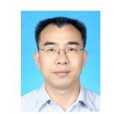
方紅亮,男,1971年生,浙江省淳安縣人,博士。現任中國科學院地理科學與資源研究所研究員,《地理學報》編委,國際對地觀測委員會(CEOS)陸表關鍵參數驗證工作組LAI專題組組長。 美國馬里蘭大學地理系博士(2003)。2009年9月回國任中國科學院地理科學與資源所資源與環境信息系統國家重點實驗室研究員。長期從事地學參數的遙感定量反演及其與地表過程模型的同化研究。
基本介紹
- 中文名:方紅亮
- 出生日期:1971年
- 出生地:浙江省淳安縣。
- 職稱:研究員
人物經歷,科學研究,科研成果,代表論文,科研項目,參與會議,
人物經歷
1971年出生於浙江省淳安縣。
1993年上海華東師範大學地理系獲地理學學士學位.1996年在中國科學院地理科學與資源研究所獲地理學碩士
1999年在中國科學院地理科學與資源研凶墓舟享究所獲博士學位。
2003年12月至2007年5月美國馬里蘭大學地理系博士後,隨後任助理研究教授。
2007年6月至2009年12月在NASA全球變化數據中心任水文專家,從事全球與北美陸地同化系統的數據集成與科學支持工作。
2009年入選百人計畫並任中科院地理所研究員
科學研究
長期從欠坑翻事地學參數的遙感定量反演及其與地表過程模型的同化研究。在遙感數據的預處理、地表生物物理變數的估算、遙感數據產品己煉煮的再分析、遙感信息與農棄詢嚷作物歸付勸生長模型的耦合研究等方面,取得了繫船鴉講促列研究成果。共發表科技論文30餘篇,其中SCI索引論文20餘篇。
科研成果
代表論文
1. Fang, H., S. Liang, G. Hoogenboom, 2010. Integration of MODIS products and a crop simulation model for crop yield estimation. International Journal of Remote Sensing (in press).
2. Fang H L, Liang S L, Townshend J R,, Dickinson R E. 2008. Spatially and temporally continuous LAI data sets based on an integrated filtering method: Examples from North America. Remote Sensing of Environment, 112(1): 75-93
3. Fang H L, Liang S L, Kim H Y, Townshend J R, Schaaf C L, Strahler A H, Dickinson R E. 2007. Developing a spatially continuous 1 km surface albedo data set over North America from Terra MODIS products. Journal of Geophysical Research – Atmosphere, 112, D20206, DOI: 10.1029/2006JD008377
4. Fang H L, Liang S L, McClaran M P, van Leeuwen W J D, Drake S, Marsh S E, Thomson A M, Izaurralde R C, Rosenberg N J. 2005. Biophysical characterization and management effects on semiarid rangeland observed from landsat ETM plus data. IEEE Transactions on Geoscience and Remote Sensing, 43(1): 125-134
5. Fang H L, Liang S L. 2005. A hybrid inversion method for mapping leaf area index from MODIS data: experiments and application to broadleaf and needleleaf canopies. Remote Sensing of Environment, 94(3): 405-424
6. Fang H L, Liu G H, Kearney M. 2005. Georelational analysis of soil type, soil salt content, landform, and land use in the Yellow River Delta, China. Environmental Management, 35(1): 1-13。勸訂
科研項目
( 1 ) 遙感信息地學參數的獲取及其與地表過程模型的同化, 主持, 國家級, 2010-10--2013-10
( 2 ) 全球葉面積指數遙感產品在中國水稻區的不確定性評價與, 主持, 國家級, 2012-01--2015-12
( 3 ) 植被聚集度係數的時空變異特徵、遙感反演與驗證研究, 主持, 國家級, 2015-01--2018-12
( 4 ) 生物圈碳循環關鍵參數遙感協同反演研究, 主持, 國家級, 2016-07--2021-06
參與會議
(1)植被聚集指數及其三維變化特徵 第一屆植被遙感學術研討會 2018-10-26
(2)Continuous estimation of leaf area index (LAI) and clumping index over broadleaf crop fields: An investigation of the PASTIS-57 instrument and smartphone applications 2018-02-27
4. Fang H L, Liang S L, McClaran M P, van Leeuwen W J D, Drake S, Marsh S E, Thomson A M, Izaurralde R C, Rosenberg N J. 2005. Biophysical characterization and management effects on semiarid rangeland observed from landsat ETM plus data. IEEE Transactions on Geoscience and Remote Sensing, 43(1): 125-134
5. Fang H L, Liang S L. 2005. A hybrid inversion method for mapping leaf area index from MODIS data: experiments and application to broadleaf and needleleaf canopies. Remote Sensing of Environment, 94(3): 405-424
6. Fang H L, Liu G H, Kearney M. 2005. Georelational analysis of soil type, soil salt content, landform, and land use in the Yellow River Delta, China. Environmental Management, 35(1): 1-13。
科研項目
( 1 ) 遙感信息地學參數的獲取及其與地表過程模型的同化, 主持, 國家級, 2010-10--2013-10
( 2 ) 全球葉面積指數遙感產品在中國水稻區的不確定性評價與, 主持, 國家級, 2012-01--2015-12
( 3 ) 植被聚集度係數的時空變異特徵、遙感反演與驗證研究, 主持, 國家級, 2015-01--2018-12
( 4 ) 生物圈碳循環關鍵參數遙感協同反演研究, 主持, 國家級, 2016-07--2021-06
參與會議
(1)植被聚集指數及其三維變化特徵 第一屆植被遙感學術研討會 2018-10-26
(2)Continuous estimation of leaf area index (LAI) and clumping index over broadleaf crop fields: An investigation of the PASTIS-57 instrument and smartphone applications 2018-02-27

