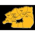
塔里木盆地亞區即狹義的塔里木盆地,面積40萬餘平方公里,其中沙漠占33.1萬平方公里,戈壁占10.5萬平方公里.地勢西高東低、微向北傾,南緣從西部的海拔1300米下降到888米(若羌),北緣從1100米(阿克蘇)降到778米(羅布泊)。
基本介紹
- 中文名:塔里木盆地亞區
- 外文名:The Tarim Basin subregion
- 別名:狹義的塔里木盆地
- 面積:40萬餘平方公里
- 沙漠占地:331萬平方公里
塔里木河偏處北緣,自西向東流.盆地中土地類型呈環狀分布,邊緣與周圍山地類型呈環狀分布,邊緣與周圍山地相連為礫石戈壁,中心是大面積沙漠.二者之間為綠洲.盆地西南部綠洲呈片狀分布(喀什—莎車三角洲上),盆地北部沿塔里木河向南呈梳齒式分布,盆地南緣呈南北排列的串珠狀分布,其間隔以荒漠.塔克拉瑪乾大沙漠是世界第二大流動性沙漠.氣候極乾旱,流動沙丘面積大(約占沙漠總面積的85%),沙丘高大而類型複雜是沙漠的特點.年降水量不足100毫米,最少者僅17毫米(若羌)。塔里木有土質平地7萬平方公里(包括土質荒漠與綠洲),如均有植被覆蓋,年需灌溉水源40—450億立方米.現有從周圍山區下泄的年徑流量約3700億立方米,可重複利用的地下水的貯量約70億立方米,如能合理利用可滿足全部7萬平方公里的灌溉需要.目前灌溉農田僅200萬畝,尚有潛力.當前首要任務是控制沙漠的南移和擴散.羅布泊為塔里木河的尾閭湖,1876—1878年普爾熱瓦爾斯基考察時,發現羅布泊位置比《大清一統圖》的羅布淖爾位置偏南,而且為淡水湖.隨即引起羅布泊為游移期的說法.實際羅布泊位置只是塔里木河尾閭變化所致,羅布泊匯於羅布窪地中,常由下游改道而在平原窪地中的河流終點積水形成新湖,舊積水地逐漸乾涸成為鹽湖.普氏所見河流改道後的新湖,位於舊羅布泊西南,稱喀拉庫順(或喀順淖爾),其上游為台特馬湖,羅氏未見羅布泊舊湖.羅布泊舊稱蒲昌海、鹽澤或牢蘭海(以其在古樓蘭附近而得名)。1952年以後在尉犁縣境築壩引水,塔里木河改道南流,以若羌縣之台特馬湖為終點;孔雀河單獨注入羅布泊.1972年以後塔里木河終點從台特馬湖退到大西海水庫.羅布泊及喀拉庫順湖水乾涸. The narrow sense the Tarim Basin, an area of 40 thousand square kilometers, accounting for 3.31 million square kilometers of which the desert, accounting for 1.05 million square kilometers of the Gobi BLane. Topography from west to east, slightly north of dumping the south from the western edge down to 1,300 meters above sea level 888 meters (Ruoqiang), 1100 meters from the northernmargin(Akzo) down to 778 meters (Lop Nor). Partial at the northern margin of the Tarim River, flowing east from the west. Basin type of a ring of land distribution, the edge type of a ring with the surrounding mountains distribution, edgeconnectedwith the surrounding mountains as the gravel Gobi, the center is a large area of desert. Between the two for the oasis. Basin in southwestern oasis was flake distribution (Kashgar - Yarkand delta), along the Tarim River basin south to the north was comb-type distribution, basin, southern margin of the north-south distribution ofstringsof beads arranged at intervals in order to desert. Taklimakan Desert is the world's second largest mobile desert. a very dry climate, large area of sand dunes (about 85% of the total area of the desert), and the type of complex is a tall sand dune desert characteristics. less than 100 mm annual rainfall, at least those who only 17 mm (Ruoqiang). Tarim has 70,000 square kilometers ofsoilplains (including the soil desert and oasis), such as vegetation cover both the annual needs of irrigation water 40-450 billion cubic meters. The current discharged from the surrounding mountains of the annual runoff of about 370 billion cubic meters, can be repeated use of groundwater storage of about 70 billion cubic meters, if therationaluse to meet the All 7 million square kilometers of irrigation needs. At present only 200 mu of irrigated farmland, there are potential. first and foremost task is to control the desert southward, and proliferation. Lop Nur in the Tarim River Tail Lake ,1876-1878 NianPoolHeat Varski study, we found Lop Nur location than the "GreatQingunified map" Rob nur southerly location, but also for freshwater lakes. which immediately caused the wavering Lop Nor period argument. the actual location of Lop Nur, but changes in the Tarim Tail caused by exchange in the Lop Nor Rob depression, they often diverted from the upstream and downstream in the plains of the river end of depression in the water toform anew lake, the old water and gradually dried up as Salt Lake. Platts can see the new post-river lake, located southwest of the old Lop Nor, saidKaralibrary shun (or Ka-shun nur), its upstream for Taiwan Tema Lake, Roche seen the old Lop Nur Lake. Lop Nur, formerly Puchang sea, salt marshes or prison Lanhai (ancient Loulan in the vicinity of its name). Yuli County border in 1952 after the diversion dam, the Tarim River diversion Nanliu to Ruoqiang County Taiwan Tema Lake end; Kongquehe single injection of Lop Nor .1972 from the years after the end of the Tarim River Lake retreat to Taiwan Tema Great WesternSeareservoir. Lop Nur lake dried up, and Kara library shun.

