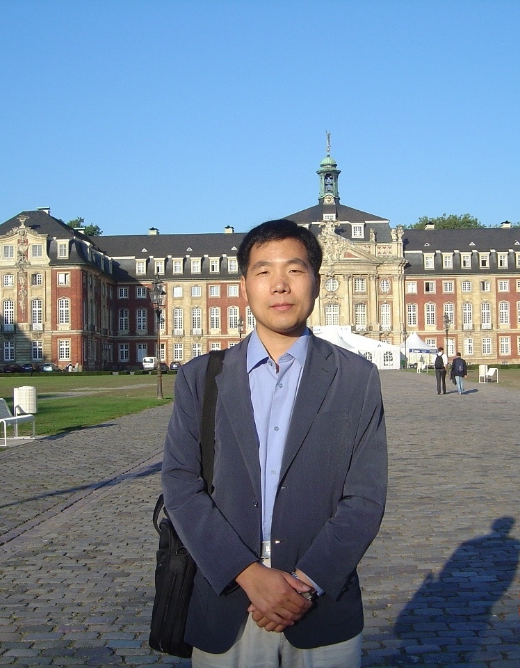
趙耀龍,教授,博士生導師,華南師範大學地理科學學院副院長,廣東省智慧國土工程技術研究中心主任。主要從事空間分析與政策模擬、空間綜合人文學與社會科學、空間藏學等方面工作。
兼任《Remote Sensing》《Landscape and Urban Planning》《Urban study research》《Science of the Total Environment》等期刊審稿人;中國地理信息產業協會理論與方法工作委員會委員、教育與科普工作委員會委員;中國地理學會歷史地理專業委員會歷史地理信息工作組組長(籌);中國自然資源學會資源製圖專業委員會委員;廣東省地理信息標準化技術委員會委員;廣東省遙感與地理信息系統學會,常務理事,教育培訓委員會副主任委員;廣東省地理學會,理事,副秘書長等。
基本介紹
- 中文名:趙耀龍
- 國籍:中國
- 畢業院校:日本筑波大學
- 學位/學歷:博士
- 職務:教授
教育背景,工作經歷,科研項目,學術成果,
教育背景
2004.04-2007.03 日本筑波大學生命環境科學研究科 空間情報科學 理學博士
1995.09-1998.06 武漢測繪科技大學(現武漢大學)地學測量工程學院 工學碩士
1991.09-1995.07 昆明理工大學國土開發與城鄉建設系 測繪工程 工學學士
工作經歷
2016.01- 廣東省智慧國土工程技術研究中心主任
2015.07- 華南師範大學地理科學學院副院長、博士生導師
2009.09- 華南師範大學地理科學學院教授
2007.04-2008.11 日本學術振興會外國人特別研究員、日本筑波大學客員研究員
2004.10-2005.03 日本筑波大學生命環境科學研究科研究助理
2004.05-2006.03 日本筑波大學生命環境科學研究科教學助理
2003.10-2004.03 日本筑波大學生命環境科學研究科研究留學生
1998.07-2009.08 昆明理工大學國土資源工程學院助教、講師、副教授
科研項目
國家自然科學基金項目:暴雨內澇防治視角下面向城市更新規劃的不透水地表空間格局最佳化模擬,2019.01-2022.12,項目負責人
國家社會科學基金重大項目:西南地區傳統村落保護與利用研究之課題一負責人--基於地理信息平台的西南地區傳統村落資料庫構建,2019.01-2023.12
教育部人文社科基金項目:藏傳佛教格魯派藏區寺院的時空演化機理與資料庫構建研究,2019.01-2021.12,項目負責人
國家社會科技基金重大項目:基於地理信息平台的藏語方言資料庫建設技術負責,課題四負責人:藏語方言時空數據共享服務平台,2015.01-2019.12
廣東省省級科技計畫項目:智慧國土中物聯網套用的關鍵技術,2015.01-2017.12,聯合項目負責人
廣東省省級科技計畫項目:特派員工作站,聯合項目負責人
廣州市產學研協同創新重大專項(no.156100021):聯合項目負責人
廣州市建設國家級科技思想庫研究課題專項:基於不透水地表空間結構最佳化的城市內澇防治調控措施研究,2013.08-2014.07
教育部留學回國人員科研啟動基金項目:城市土地利用時空演變中鄰域的空間相互作用機制研究,2012.07-2015.06
973計畫前期研究專項(2014CB460614):全球化背景下的區域人文回響:以廣東省為例,2015.01-2016.12(主要成員)
國家自然科學基金項目:變化環境下南方濕熱區韓江流域景觀格局演變與生態水文耦合研究,2015.01-2018.12(第二負責人)
國家“十二五”科技支撐計畫課題:村鎮區域空間規劃與土地利用最佳化技術集成示範,2011.01-2015.12
國家自然科學基金項目:NPP驅動下城市邊緣區碳匯時空演變的地理模擬研究,2012.01-2015.12(第二負責人)
學術成果
1,書籍
2015,趙耀龍,易紅,鄭春燕,李長輝,宋濤,曾桂香編著,地圖學基礎,北京:科學出版社
2012,Zhao Yaolong, Chapter 4 and 15,Progress in Geospatial Analysis, Murayama, Yuji (Ed.), Springer Press. 291p.
2012, 張洪,車學文,趙耀龍,孟春林,金傑編著 城市土地供給與耕地保護監管――理論、模型和系統. 昆明:雲南科技出版社
2011,Zhao Yaolong, Chapters 2,4, 5, and 10.Spatial Analysis and Modeling in Geographical Transformation Process, Murayama, Yuji; Thapa, Rajesh Bahadur (Eds.), Springer Press
2,近幾年專業學術論文(*為通訊作者)
2018,Yu Huafei,Zhao Yaolong*, Fu Yingchun, Li Le.Spatiotemporal variance assessment of urban
rainstorm waterlogging affected by impervious surface expansion: a case study of Guangzhou, China.Sustainability, 2018, 10(10): 3761. (SSCI, SCI)
rainstorm waterlogging affected by impervious surface expansion: a case study of Guangzhou, China.Sustainability, 2018, 10(10): 3761. (SSCI, SCI)
2018, Li Le,Zhao Yaolong, Fu Yingchun, Xin Qinchuan.Satellite-Based Models Need Improvements on Simulating Annual Gross Primary Productivity: A Comparison of Six Models for Regional Modeling of Deciduous Broadleaf Forests.Remote Sensing, 2018, 10(7), 1008. (SCI)
2018, Tan Xianzhe, Shu Yuqin, Lian Yanqing,Zhao Yaolong, Fu Yingchun. A spatial assessment of urban waterlogging risk based on a Weighted Naïve Bayes classifier.Science of the Total Environment,630(2018), 264-274. (SCI)
2017, LiLe,Zhao Yaolong*, Fu Yingchun, Pan Yaozhong, Yu Le, Xin Qinchuan. High Resolution Mapping of Cropping Cycles byFusion of Landsat and MODIS Data.Remote Sensing, 2017, 9, 1232. (SCI)
2015, Jizhe Xia, Kevin M. Curtin, Weihong Li, andYaolong Zhao. A New Model for a Carpool Matching Service.PLOS ONE, 10(6):e0129257 (SCI)
2014, Fu Yingchun, Tang Congguo, Li Jun,Zhao Yaolong*, Zhong Wei, Zeng Xiantie. Sources and transport of organic carbon from the Dongjiang River to the Humen outlet of the Pearl,Journal of Geographical Sciences, 24(1), 143-158.(SCI)
2013, Fu Yingchun, Lu Xueyu,Zhao Yaolong*, Zeng Xiantie, Xia Lili. Assessment impacts of climate and LULC changes on urban carbon sequestration: a case study in Guangzhou, China.Remote Sensing, 5(8), 4125-4144(SCI)
2013, Fu Yingchun, Guo Taisheng,Zhao Yaolong. Effects of LUCC on Soil Organic Carbon Variations in the Dongjiang of the Pearl River Delta, China.2013. International Journal of Digital Content Technology and its Applications, 7(2), 731-739
2013, Fu Yingchun,Zhao Yaolong,Zhang Yongrui, Guo Taisheng, He Ziwei, Chen Jingyi. GIS and ANN-based spatial prediction of DOC in river networks: a case study in Dongjiang, Southern China.Environmental Earth Sciences, 68(5): 1495-1505 (SCI)
2012,Zhao Yaolong, Zhang Ke, Fu Yingchun, and Zhang Hong. Examining land-use/land-cover change in the Lake Dianchi watershed of the Yunnan-Guizhou plateau of southwest China with remote sensing and GIS techniques: 1974–2008.International Journal of Environmental Research and Public Health. 9(11), 3843-3865. (SCI)
2012, Zhang Ke,Zhao Yaolong*and Zhang Hong. Monitoring land use/land cover changes of Kunming city based on remote sensing technology and spatial metrics.IEEE GeoInformatics 2012, 1-5.(EI)
2011,Zhao Yaolong, Cui Bingliang and Murayama Yuji. Characteristics of neighborhood interaction in urban land-use changes: a comparative study between three metropolitan areas of Japan.Journal of Geographical Sciences, 21(1), 65-78.(SCI)
2010,Zhao Yaolong. “One Map”-based land information system.IEEE 2010 International Conference on E-Business and E-Government, 687-690. (EI)
2010,Zhao Yaolong, Dong Fei and Zhang Hong. Should neighborhood effect be stable in urban geosimulation model? A case study of Tokyo.Lecture Notes in Computer Science, 6016, 134-143. (EI)
2009, Li Yan,Zhao Yaolong*and Gui Renyi. Spatio-temporal analysis of farmland change in Yunnan province: 1996-2008. In:Wu G., Deng J., Lei Y. and Wan L. eds., Life, Environment and Energy. Geological Publishing House, 56-61.
2009, Zhang Xiaoling,Zhao Yaolongand Zhu Lanyan. Intensive use of Kunming urban land at macro scale, Yunnan province. In:Wu G., Deng J., Lei Y. and Wan L. eds., Life, Environment and Energy. Geological Publishing House, 532-538.
2009,Zhao Yaolongand Murayama Yuji. Characteristics of neighborhood interaction in urban growth: same for different areas?Urban Development, Planning and Governance in Globalization, IGU Urban Commission
2008,Zhao Yaolong,Junsan Zhao and Murayama Yuji. Modeling and predicting urban growth pattern of the Tokyo metropolitan area based on cellular automata. Proc. SPIE, Vol. 7143, 71431Q. (EI)
2007,Zhao Yaolongand Murayama Yuji. Urban growth in the Tokyo metropolitan area: Insight from urban form and landscape. In:Yan X. and Xue, D. eds., Urban Development, Planning and Governance in Globalization.IGU Urban Commission. Sun Yat-Sen University Press, 371-389.
2007,Zhao Yaolongand Murayama Yuji.A new method to model neighborhood interaction in Cellular Automata-based urban geosimulation.Lecture Notes in Computer Science, 4488, 550-557.(EI)
2006,Zhao Yaolongand Murayama Yuji.Urban dynamics analysis using spatial metrics: A case study of Yokohama city.Tsukuba Geoenvironmental Sciences, 2, 9-18.
2006,Zhao Yaolongand Murayama Yuji.Effect of spatial scale on urban land-use pattern analysis in different classification systems: An empirical study in the CBD of Tokyo.Theory and Applications of GIS, 14(1), 29-42.
2005,Zhao Yaolong, Murayama Yuji. Effect characteristics of spatial resolution on the analysis of urban land use pattern: a case study of CBD in Tokyo using spatial autocorrelation index. In:Murayama, Y. and Du, G.., eds., Cities in Global Perspective: Diversity and Transition. IGU Urban Commission, Tokyo, 585-594.
2005, Zhao Junsan,Zhao Yaolong, Zhao Qiaogui. The data center implementation of land and resources information management in provincial level. In:Murayama, Y. and Du, G.., eds., Cities in Global Perspective: Diversity and Transition. IGU Urban Commission, Tokyo, 559-567.
2005,Zhao Yaolong, Murayama Yuji, Zhang Yumin. Field-based fuzzy spatial reasoning model for Geographical Information Systems: Case of constraint satisfaction problem. Theory and Applications of GIS, 13(1), 21-31.

